ATOS Tracking System
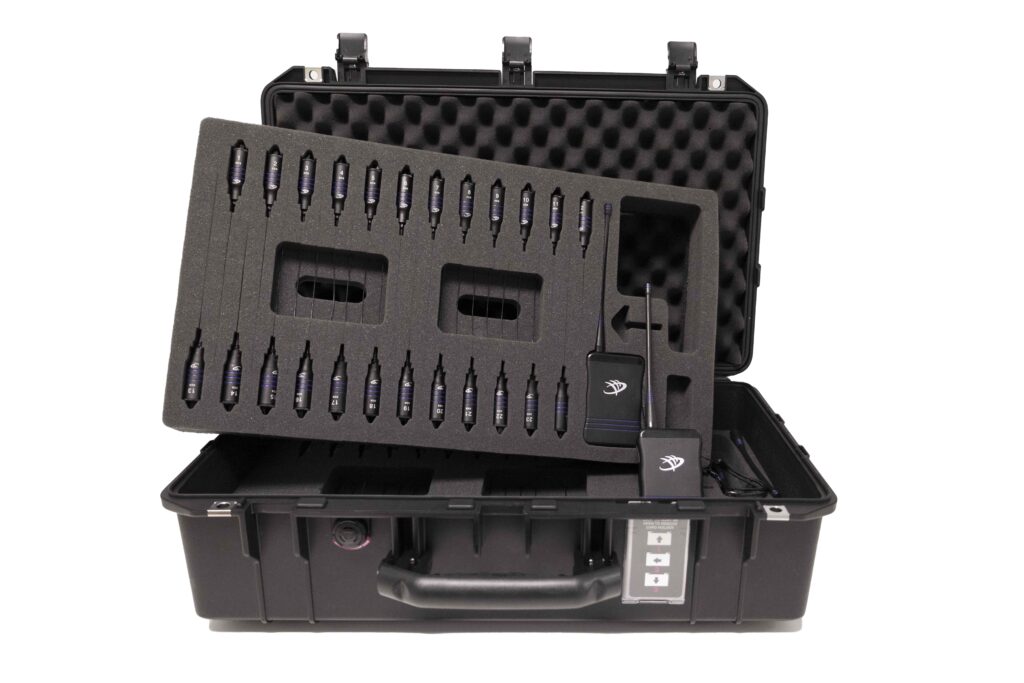
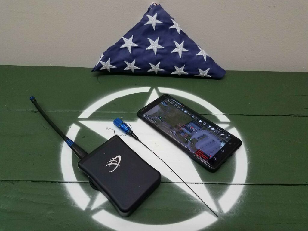
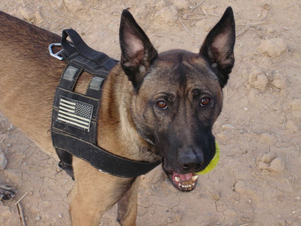
ATOS provides a tracking solution for object on the battlefield or work site (to include working dogs, personnel, vehicles, aircraft, etc.) gives the user the upper hand which can make all the difference. With features such as: precision targeting, navigation, data sharing, and reconnaissance, the Android Tactical Observation and Surveillance system (ATOS) is an organic line of sight (LOS) tracking system that runs inside of the Android Team Awareness Kit (ATAK) or ATAK-CIV for non military users. ATOS consists of three components: the Samsung phone or tablet, the ATOS Tag, and the Command Link. ATOS operates in the UHF spectrum, independent of cellular, Wi-Fi or satellite networks for when you are in rugged or remote locations away from infrastructure support.

Why ATOS?
ATOS is the only ruggedized LOS tracking system compatible with ATAK. ATAK is a military, first responder, and or public safety situational awareness app that pairs with the ATOS command link to track and monitor ATOS tags from 1-4 KM on the ground and up to 30+ km in/from the air. The ATOS plugin can be used to broadcast the location of certain tags to all or selected members on the ATAK network if connectivity is available. Tags are displayed on screen in real time and are shown as icons that are selectable and can have task/purpose, name/ID, contact information, and special equipment can be added to provide users with useful information regarding the tags being tracked.
Integration with ATAK
ATAK is a geospatial infrastructure and military situational awareness app that pairs with the ATOS command link to track and monitor ATOS tags from 1-4 KM on the ground and up to 30+ km in/from the air. The ATOS plugin can be used to broadcast the location of certain tags to all or selected members on the ATAK network. Tags are displayed on screen in real time and are shown as icons that are selectable and can have task/purpose, name/ID, contact information, and special equipment can be added to provide users with useful information regarding the tags being tracked.

Command Link, EUD, Tags
The command link connects wirelessly to the ATAK end user device (EUD) by Bluetooth to receive GPS locations transmitted via UHF signal. Users can track up to 200 ATOS tags which can be assigned to designators such as: military working dogs, personnel, equipment, or vehicles.
The tags are small and highly ruggedized GPS receiver/transmitters powered by a C123 battery and are about the size of your thumb.They weigh about 2 ounces with a 7 inch antenna. The GPS location is transmitted via UHF range and will send an updated position once every 2 to 6 seconds with a battery life of up to 48 hours.The tags can withstand temperatures from -40 to 150 degrees Fahrenheit. The UHF receiver is small, constructed out of machined aluminum, watertight and has no moving parts. It has a rechargeable battery (via USB-C) and removable 6″ whip antenna which can be connected to a 3′ whip antenna for increased reception range.
Behind the Name
The ATOS tracking system by Tough Stump Technologies is named in honor of Atos. A military working dog serving with the 2nd Ranger Battalion who was KIA on Christmas Eve 2007 in Iraq while tracking an enemy in dense vegetation. His sacrifice saved several Ranger’s lives and terminated the enemy combatant he was searching for. His full story can be found here.

About Tough Stump Technologies
Tough Stump Technologies is a Veteran Owned Small Business that fuses the latest remote sensing technology with over 150 years of combined experience in small unit tactics, SUAS operations and air-to-ground integration, combined with the highest standards of integrity and performance.
With service in all four branches of the US military and Special Operations units, the members of our team are expertly equipped to help you succeed.
Interested in Purchasing ATOS?
Contact our Tough Stump team for more information.
Comments +