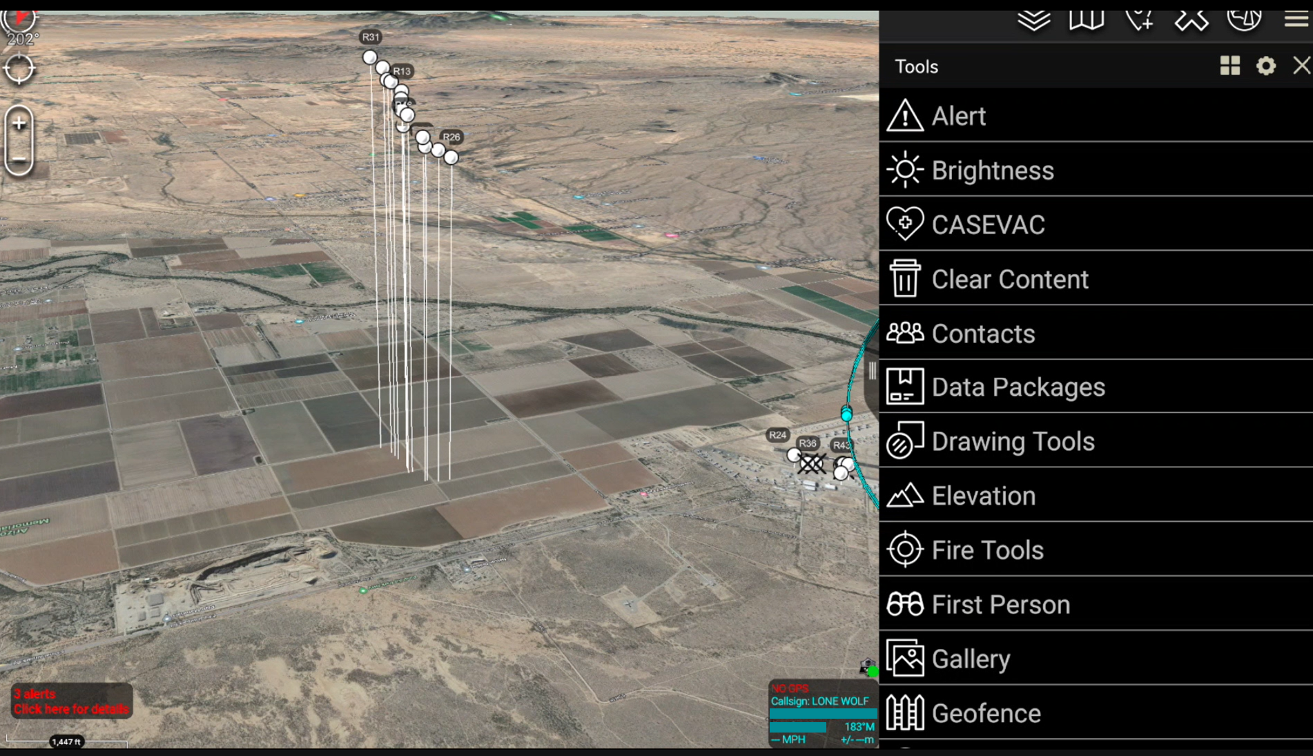
Robotics use in ATAK/TAK: The framework of ATAK gives the users and developers a nearly limitless system to run situational awareness programs that will help ensure that the hero’s using ATAK can achieve a safe, successful mission. One of the great features of ATAK is the robotics plug-ins. The UAS Tool Kit is a program […]
You can either type this featured post content manually or use a post look-up function in SHOWIT directly. It can also rotate between several posts.
Robotics use in ATAK/TAK: The framework of ATAK gives the users and developers a nearly limitless system to run situational awareness programs that will help ensure that the hero’s using ATAK can achieve a safe, successful mission. One of the great features of ATAK is the robotics plug-ins. The UAS Tool Kit is a program […]
REad the post →
How to get 3D models in TAK: Surface terrain in ATAK/TAK is easily placed by loading DTED (Digital Terrain Elevation Data) to the back files of ATAK. What can be done to view objects that are on, and sometimes above the surface. ATAK will take user created digital 3D models by loading the correct files […]
Coordinates in ATAK Mapping coordinate systems are derived from lines of Latitude and Longitude. Latitude lines start at the equator and climb 90° North (Northing) and 90° South (Southing). Lines of Longitude start at the Prime Meridien and travel 180° East (Eastings) and 108° West (Westings). As these lines cross, in degrees, minutes and sometimes […]
REad the post →
Where Did ATAK Come From? There are probably many origin stories about the creation of the Android Tactical Assault Kit or Android Team Awareness Kit (ATAK). At Tough Stump Technologies most of the senior members of the company fielded and assisted in the development of ATAK and some early plug-ins. 90% of the company served […]