


Where Did ATAK Come From?
There are probably many origin stories about the creation of the Android Tactical Assault Kit or Android Team Awareness Kit (ATAK). At Tough Stump Technologies most of the senior members of the company fielded and assisted in the development of ATAK and some early plug-ins. 90% of the company served in the arm forces prior to becoming Tough Stumpers and were introduced to ATAK around 2010.
Prior to 2010, the military was reliant on paper maps and a program called Falcon View, created and maintained by Georgia Tech Research Institute. As the advent of smartphones populated the civilian market, the military for the 1st time was slow to game. The need aroused for smartphone enabled, situational awareness, communication, secure information sharing moving map program. The need was a mix of many programs from different sources like Google Earth, text, “Big Green” military radios and GPS enabled navigation aids. The ask was put to industry and the Air Force Research Laboratory (AFRL) delivered ATAK.
Why Android
AFRL needed an operating system that would allow the end users to add their mission specific functionality with ease and a cost-effective delivery system. Android was a popular program and met the needs for TAK.
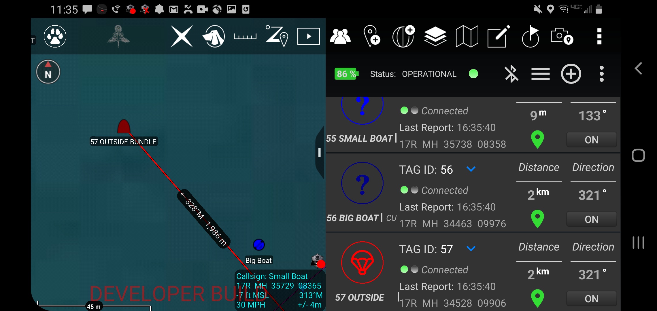
TAK works on Apple smart-devices (iTAK) and Microsoft Windows systems (WINTAK). The ITAK has limited functionality as the iPhone/iPad have a robust approval system to integrate non-Apple sanctioned products. WINTAK is a fully interoperable system with ATAK with a different layout and user interface. Android OS will allow the end user to upload specific things to accomplish their mission:
- 3D models and maps
- Controlling Unmanned Aerial Vehicles (UAV/Drones)
- Digital Terrain Elevation Data (DTED)
- Specific maps
- 1:50
- Nautical Charts
- Google Satellite
- Bluetooth enabled devices
- Laser Range Finders
- Trimble Survey Tools
- Specific Icon Pallets
- GPS Tracking tags (ATOS)
- And many more
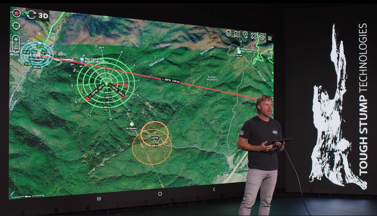
ATAK Uses
Outside of daily military operations, ATAK/TAK has been used by a multitude of government agencies like the Department of Homeland Defense, FEMA, Customs and Border Patrol and California Fire. These agencies use TAK to protect and rescue American. Specifically, TAK was used to safely rescue 2000 citizens in seven major hurricanes (Harvey, Irma, Maria, Florence, Lane, Michael, and Dorian).
TAK is free to the public as are most of the plug-ins all downloadable from www.tak.gov and the Google play store. Tough Stump Offers TAK University an online training course hosted by Adobe’s Learning Management System. Visit toughstump.com to learn more about ATAK training.


Comments +