


Coordinates in ATAK
Mapping coordinate systems are derived from lines of Latitude and Longitude. Latitude lines start at the equator and climb 90° North (Northing) and 90° South (Southing). Lines of Longitude start at the Prime Meridien and travel 180° East (Eastings) and 108° West (Westings). As these lines cross, in degrees, minutes and sometimes seconds, the user will get a 2D coordinate or X and Y coordinate. For the 3rd coordinate, the Z coordinate, the user will need to know the ground elevation relative to Mean Sea Level (MSL). In ATAK the ingested elevation data is known as Digital Terrain Elevation Data or DTED.
What is DTED
DTED is derived from radar signals reflected on the Earth’s surface. The individual elevation values are generated from signals reflected by an area on ground of an approximate size of 25 x 25 m. The model is transformed into geographic coordinates and is provided in tiles of 15′ (arc-minute) size in latitude and longitude. This data is collected by mapping agencies and made available for ATAK uses by USGS (United States Geological Survey), a branch of the Department of Interior. The level of DTED represents the accuracy of the data. Here are the definitions of DTED from the National Geospatial Agency:
- DTED Level 0 corresponds to small scale hardcopy products and has a post spacing of 30 arc-seconds, or one-kilometer nominal resolution.
- DTED Level 1 corresponds to medium scale hardcopy products and has a post spacing of three arc-seconds, or 100-meter nominal resolution.
- DTED Level 2 corresponds to medium to large scale hardcopy products and has a post spacing of one arc-second-, or 30-meter nominal resolution.
Basically, the higher the level of DTED the more accurate the elevation data is.
What are my DTED levels in ATAK
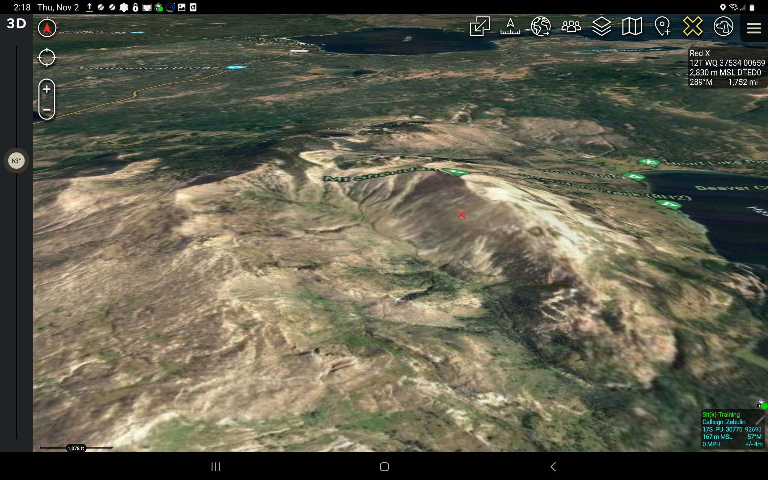
In ATAK/TAK the users can check their DTED levels quickly, by using the Red X tool. The Red X tool is a quick method to grab coordinates on the user’s map. The Red X tool will show the elevation data with the level of DTED associated with the area of the map. There are a few platforms that will provide DTED to the ATAK user, we at Tough Stump Technologies use https://earthexplorer.usgs.gov/ to download DTED. Here is a tutorial on how to use USGS earth explorer to get DTED into ATAK/TAK: https://youtu.be/1pgaGbGBZb8?si=j84fzeVpb30GJlxA
TAK U
Now that we’ve gone over the coordinates in ATAK, it’s time to lay a good foundation for ATAK users. Sign up for our newest course: TAK University. At Tough Stump Technologies, we have developed this online ATAK training to support our heroes in safely and efficiently crushing their missions.


Comments +