


How to get 3D models in TAK:
Surface terrain in ATAK/TAK is easily placed by loading DTED (Digital Terrain Elevation Data) to the back files of ATAK. What can be done to view objects that are on, and sometimes above the surface. ATAK will take user created digital 3D models by loading the correct files in the Overlays file then rendering a usable 3D digital model over the surface of the chosen map. The user can inspect these images by using 3D mode as sub-menu to the compass tool on main screen.
How are 3D models in TAK are made:
3D models are derived from JPEG images gathered by any digital camera system. This can be smartphones, UAV’s, UGV’s and digital cameras. There are more advanced processes that can break down video formats. When the digital images are gathered, a Photogrammetry program will process the data to create a Digital Surface Model (DSM) and Orthomozaic. The more pictures taken of the object the better the 3D model will be. For example, a multi rotor UAV can do a mapping mission over a building, simultaneously another UAV can get images of the sides of the building. Upload as many JPEG’s as possible to create the best image. Once processed, the user will need to extract 6 files for ATAK to create the 3D model:
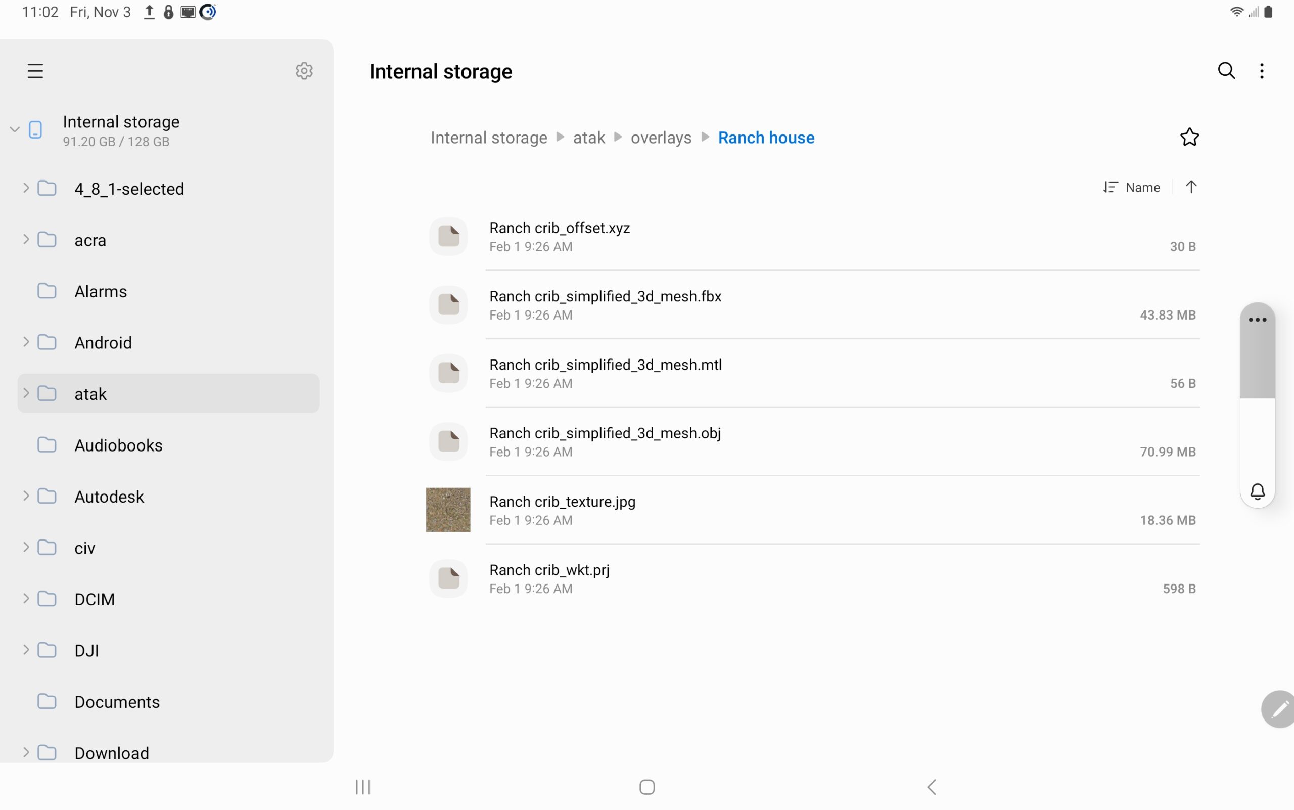
You can see the upload path above: Smart device > Internal storage > atak > overlays. ATAK will automagically render the 3D image.
Viewing 3D Models in TAK:
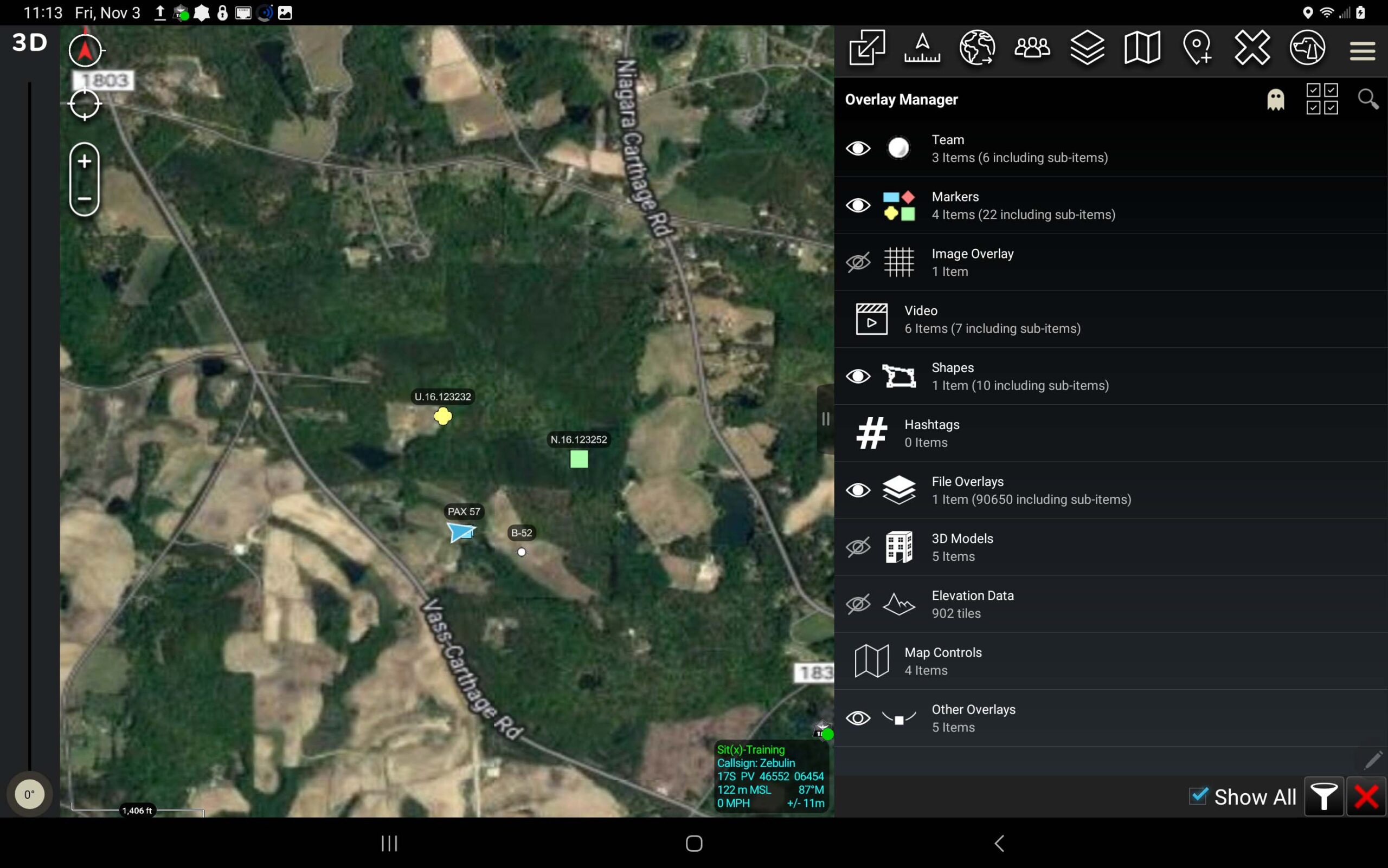
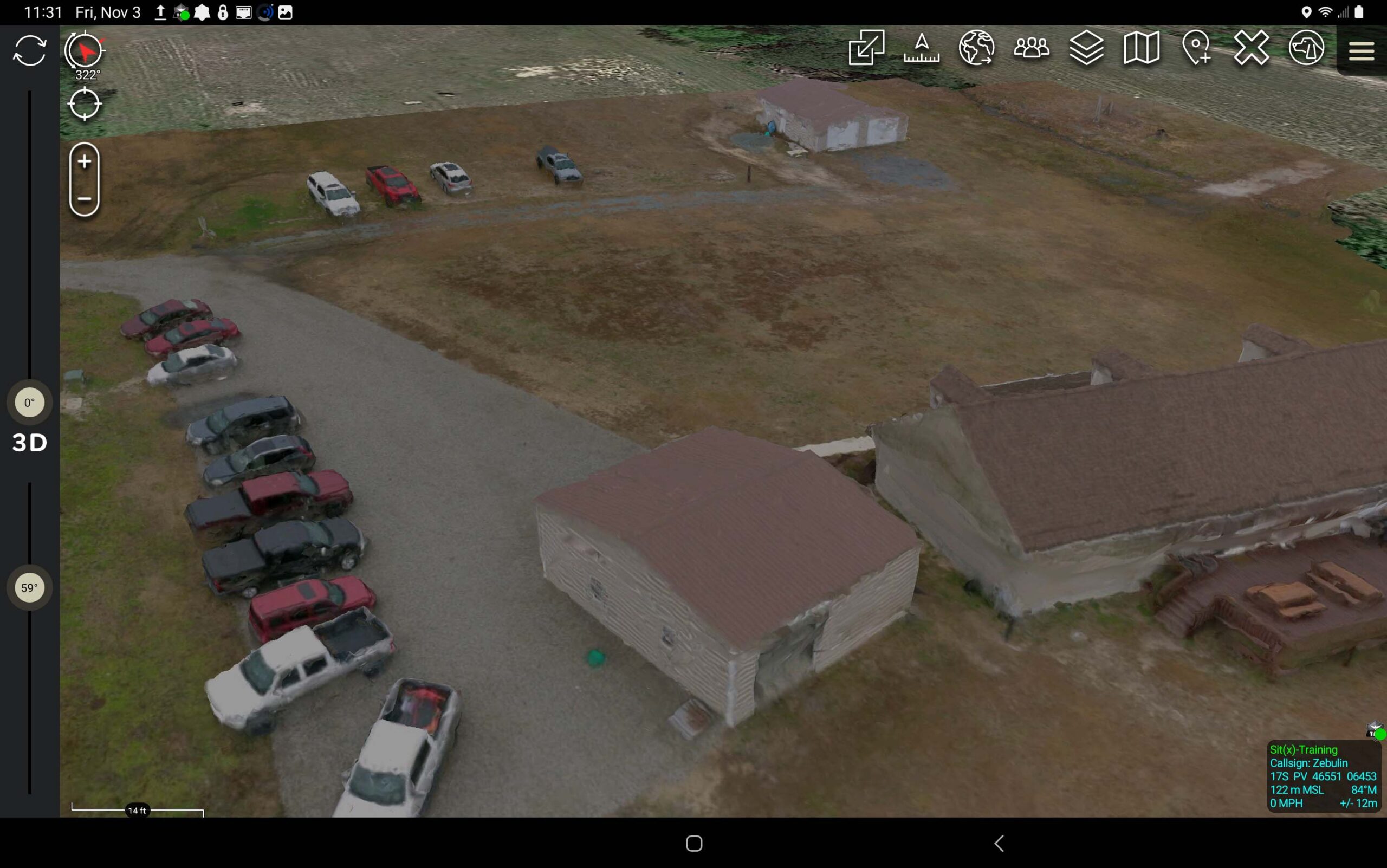
After the user uploads the file, the site where the images were collected will render the 3D model. The Overlay Manager will give the user access to all 3D models. It will activate and snap to the image location. To manipulate the 3D model, Long press the Compass Tool to reveal the Pivot and 3D action. Now all TAK users can analyze the model from all angles.
Where can you learn more:
For in-depth instructions on how to use UAV’s for creating 3D models and maps Tough Stump has a proprietary program called ARTEMIS which is a 4 day course on flying the eBee Tactical to collect images tethered with PIX 4D photogrammetry software to process the data. This data can be analyzed and put into ATAK. TAK University is an online, self-paced course that will give the user the basics of functioning ATAK. Coming later this year will be more in-depth classes on advance ATAK uses.
Sign up for Tough Stump Technologies’ TAK University HERE.


Comments +